Welcome to the Ultimate Guide on Mastering Summer Camp Navigation
Welcome to the ultimate guide on mastering the art of navigating summer camps with the perfect Summer Camp Map. Whether you’re a camper or a parent, understanding the types of maps available can transform your camp experience into a seamless adventure. From traditional paper maps to interactive digital versions, each type offers unique benefits tailored to different needs.
What You’ll Learn
In this article, we’ll explore the key features of effective summer camp maps, how to read them, and even how to customize your own. We’ll weigh the pros and cons of digital versus physical maps, introduce popular map providers, and share tips for safe and efficient navigation.
Ensuring a Safe and Enjoyable Camp Journey
Let’s ensure your camp journey is both enjoyable and safe, with maps that are engaging, up-to-date, and tailored to every camper’s needs.
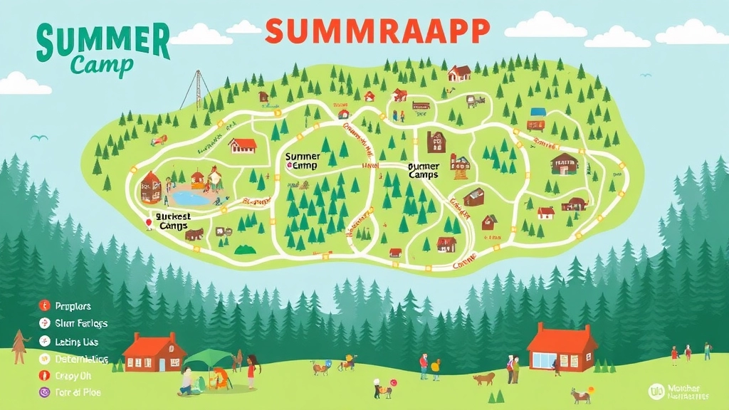
Types of Summer Camp Maps
Alright, let’s dive right into it. When it comes to summer camp maps, there are a few types that you’ll come across. And trust me, understanding these can make your camp experience way smoother.
Traditional Paper Maps
Remember those foldable maps you get at national parks? Yeah, summer camps have them too. These are your basic, no-frills maps that show you the lay of the land. They’re great because:
- No batteries needed: They never run out of juice.
- Easy to carry: Just fold and stuff in your pocket.
- Simple to use: No tech skills required.
Digital Maps
Got a smartphone? Then you’re in luck. Many camps now offer digital maps you can access via an app or website. These are a game-changer because:
- Interactive features: Zoom in, zoom out, click on landmarks.
- Real-time updates: Know if a trail is closed or if there’s a sudden change in schedule.
- GPS integration: Helps you not get lost, which is always a plus.
3D Maps
These are the cool kids on the block. 3D maps give you a more realistic view of the camp terrain. They’re particularly useful for:
- Understanding elevation: Know if you’re in for a steep hike.
- Visual learners: If you’re someone who needs to see it to believe it, these maps are for you.
Custom Maps
Some camps go the extra mile and create custom maps tailored to specific activities or groups. These could include:
- Activity-specific maps: Maps that highlight the best routes for hiking, canoeing, or even bird-watching.
- Group-specific maps: Tailored for different age groups or skill levels, making sure everyone can navigate comfortably.
Interactive Maps for Kids
These are designed to be fun and engaging, often featuring:
- Games and challenges: Turn navigation into a scavenger hunt.
- Kid-friendly icons: Simple symbols that kids can easily understand.
- Safety features: Clear markings of safe zones and emergency points.
Why Understanding Map Types Matters
You might be thinking, “Why do I need to know all this?” Here’s the deal:
- Better planning: Knowing what type of map you’ll have helps you prep better.
- Enhanced experience: The right map can make your camp experience more enjoyable and less stressful.
- Safety: The more familiar you are with the terrain, the safer you’ll be.
Real Talk: My Experience with Summer Camp Maps
When I first went to summer camp, I had no clue about the different types of maps. I remember getting lost on the way to the mess hall because I was relying on a paper map that got soaked in the rain. If I had known about digital maps back then, I would have saved myself a lot of trouble.
So, take it from me â understanding these map types isn’t just useful; it’s essential. Whether you’re a camp newbie or a seasoned pro, knowing your way around these maps can make all the difference. For more tips on having a great camp experience, check out our Ultimate Packing Guide and learn about Shuttle Bus Services for Summer Camps.
Key Features of Effective Summer Camp Maps
Ever been lost at a summer camp? It’s a nightmare.
You need a map that works, right?
Let’s break down the key features of effective summer camp maps.
Clear and Simple Design
First off, they’ve got to be easy to read.
No one wants to squint at tiny fonts or decipher complex symbols.
- Bold labels for key areas like cabins, dining halls, and activity zones.
- Colour-coded sections to differentiate between areas.
- Clear legends to explain symbols and landmarks.
Accurate and Up-to-Date Information
Nothing’s worse than outdated info.
- Current landmarks and paths.
- Recent changes like new buildings or closed trails.
- Emergency exits clearly marked.
Scale and Distance
Knowing the distance between points is crucial.
- Distance markers to show how far you’ll need to walk.
- Scale bars to give a sense of proportion.
Landmarks and Points of Interest
Make it easy to find the cool spots.
- Highlight key landmarks like lakes, climbing walls, and sports fields.
- Points of interest for activities and scenic views.
Safety Features
Safety first. Always.
- Emergency stations and first aid points clearly marked.
- Evacuation routes for quick exits.
- Meeting points for group gatherings.
Weatherproof Material
If you’re going physical, make it last.
- Durable and weatherproof materials.
- Water-resistant coatings for outdoor use.
Interactive Elements
If you’re going digital, make it engaging.
- Clickable icons for more info.
- Zoom features to get a closer look.
- Search functions to find specific spots.
Personalisation Options
Everyone’s different.
- Customisable routes for different activities.
- Personal notes sections for campers to add their own info.
Real-Life Example
Think back to that one camp where you couldn’t find the archery range.
You wandered around, frustrated, until someone pointed you in the right direction.
A good map would’ve saved you all that hassle.
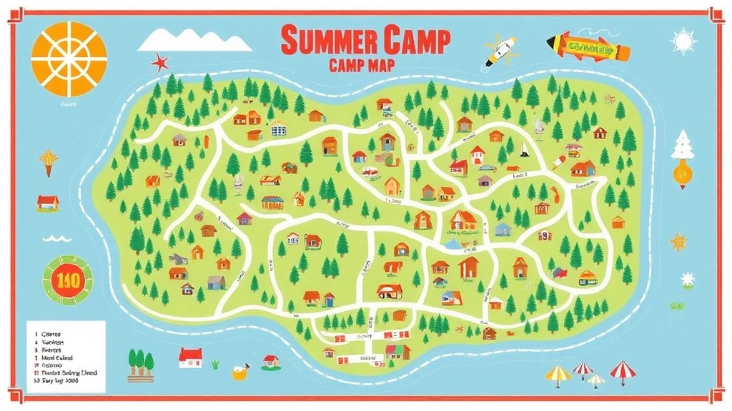
How to Read a Summer Camp Map
Ever found yourself staring at a summer camp map, scratching your head, and wondering, “Where the heck am I?” You’re not alone. Let’s break it down so you can navigate like a pro and enjoy every moment of your camp experience.
The Basics: What Am I Looking At?
First things first, a summer camp map is your best friend in unfamiliar territory. It’s got all the info you need to get from point A to point B without getting lost. Here’s how to get started:
- Legend/Key: This is your cheat sheet. It tells you what all those symbols and colours mean. Look for icons representing cabins, dining halls, restrooms, activity areas, and emergency stations.
- Compass Rose: This shows you the cardinal directions (North, South, East, West). Knowing which way is north can help you orient yourself.
- Scale: This helps you understand distances. If the scale says 1 inch = 100 feet, you can measure the distance between two points to see how far you’ll be walking.
Getting Your Bearings: Where Am I Now?
Before you start navigating, you need to know where you are. Look for a “You Are Here” marker. If there isn’t one, find a landmark you can identify on the map and match it to your surroundings.
Plotting Your Course: Where Do I Want to Go?
Once you know where you are, it’s time to figure out where you want to go. Here’s a simple way to plan your route:
Customizing Your Own Summer Camp Map
Ever tried finding your way around a summer camp and ended up lost? Yeah, me too. Customizing your own summer camp map can save you from that hassle. Let’s dive into how you can make a map that’s not just functional but also a lifesaver.
Why Customise Your Summer Camp Map?
First off, why bother? A customised map is tailored to your needs. It highlights the spots you care about. It’s like having a personal guide in your pocket.
Steps to Customise Your Summer Camp Map
1. Identify Key Locations:
- Cabins: Know where you’re sleeping.
- Dining Hall: Because you need to eat.
- Activity Zones: Archery, swimming, hiking trails – mark them all.
2. Add Landmarks:
- Big Trees, Rocks, or Statues: These can help you orient yourself.
- Water Sources: Lakes, streams, or fountains.
3. Use Clear Symbols:
- Icons: Use universally understood symbols.
- Colours: Different colours for different types of locations. Green for nature spots, red for emergency points, etc.
4. Include a Legend:
- Key: Explain what each symbol and colour means.
- Scale: Helps you gauge distances.
Tools to Help You Customise
- Google My Maps: Easy and free.
- Canva: For a more visually appealing map.
- Mapbox: If you need advanced customisation.
Real-Life Example
Once, I was at a camp where the standard map was a joke. I made my own, marking shortcuts and hidden spots. It turned a confusing place into a familiar playground.
Benefits of a Customised Map
- Efficiency: No more wandering around.
- Safety: Quick access to emergency points.
- Enjoyment: Spend more time having fun, less time figuring out where you are.
Digital vs. Physical Summer Camp Maps
Ever wondered whether a digital or physical summer camp map is better? You’re not alone. Let’s dive into the pros and cons of each so you can make the best choice for your camp experience.
Why Choose a Digital Summer Camp Map?
Digital maps have become all the rage, and for good reason. Here’s why they might be your best bet:
- Real-Time Updates: Digital maps can be updated instantly. If a trail closes or a new activity area opens, you’ll know right away.
- Interactive Features: Zoom in, zoom out, click for detailsâdigital maps are interactive and engaging.
- Accessibility: Access your map on any device. Whether it’s your phone, tablet, or laptop, your map is always at your fingertips.
When a Physical Summer Camp Map Shines
There’s something about holding a map in your hands. Here’s why some still swear by physical maps:
- No Battery Required: You don’t need to worry about your device dying. A physical map is always ready to go.
- Tactile Experience: Some people simply prefer the feel of paper. It’s easier on the eyes, too.
- Easy Sharing: Pass it around, mark it up, fold it, and keep it. Sharing a physical map can be more straightforward in group settings.
Digital vs. Physical: Which One to Pick?
Consider these factors:
- Connectivity: If your camp has spotty internet, a physical map might be more reliable.
- Preference: Some folks just love the old-school charm of a paper map.
- Purpose: For detailed planning or large-scale navigation, digital maps often offer more features.
My Personal Take
When I was at camp, we had both. Digital maps were great for planning, but when we hit the trails, physical maps were our go-to. It was like having a backup plan that never failed.
Making the Most of Your Map
- Combine Both: Use digital maps for planning and physical maps for on-the-ground navigation.
- Stay Updated: If you’re using digital, make sure your app is up-to-date.
- Practice: Familiarise yourself with both types of maps before you need them.
For more tips on enhancing your camp experience, check out our top summer camping tips and gear essentials and explore fun and educational summer camp activities.
Popular Summer Camp Map Providers
Alright, let’s talk about something that really matters when you’re heading to a summer camp: Popular Summer Camp Map Providers.
Ever been lost in a camp with no clue where the dining hall is? Or the swimming pool? Yeah, me too.
Having a reliable map can save you a ton of hassle.
Here are some top providers that make life easier for campers and organisers alike:
Map My Camp
These folks know their stuff.
They offer custom maps tailored to your camp’s layout.
- Easy to Read: Clear labels and colour-coded areas.
- Interactive Features: Clickable icons if you’re using the digital version.
- Customisation: Add your camp’s unique spots.
Camp Map Co.
Another big player in the game.
Their maps are detailed, yet simple to navigate.
- User-Friendly: Even kids can figure it out.
- Durable Prints: Waterproof options for those rainy camp days.
- Digital Versions: Perfect for smartphones and tablets.
Scout Maps
Got a scout camp? These guys specialise in that niche.
- Detailed Terrain: Perfect for hikes and nature trails.
- Safety Features: Marked emergency exits and first aid stations.
- Custom Icons: Tailored to scouting activities.
Why It Matters
Choosing the right map provider isn’t just about convenience.
It’s about safety and making sure everyone has a great time.
Imagine little Johnny getting lost on his way to the archery range. Not fun.
Real Talk: My Experience
Last summer, I organised a camp and used Map My Camp.
The kids loved the interactive features, and the waterproof prints were a lifesaver.
I could focus on fun activities rather than worrying about lost campers.
How to Pick the Right Provider
Here’s a quick checklist:
- Customisation Options: Does the provider offer tailored maps?
- Durability: Are the physical maps waterproof?
- Digital Compatibility: Can you access the map on a smartphone?
- User-Friendliness: Is it easy for both kids and adults to read?
Tips for Navigating with a Summer Camp Map
Ever found yourself lost in the maze of a summer camp? Yeah, it’s a real pain. But guess what? With the right tips for navigating with a summer camp map, you’ll feel like a pro in no time. Let’s dive in.
Understanding the Basics
First off, let’s get the basics down. You’ve got your map, but now what? Here’s what you need to focus on:
- Legend: This is your map’s cheat sheet. It tells you what all the symbols mean.
- Scale: Helps you understand distances. Is it a 5-minute walk or a 30-minute hike?
- Compass Rose: Shows you which way is north. Always handy to know where you’re headed.
Real-Life Scenario
Imagine you’re at Camp Green Lake. You’ve got three activities lined up: archery, swimming, and a nature hike. Your map shows all these spots, but how do you get there without wandering aimlessly?
Step-by-Step Navigation
- Identify Your Starting Point: Look for the âYou Are Hereâ marker. If it’s not there, find a landmark you recognise.
- Plot Your Route: Draw an imaginary line or even use a pencil to mark your path.
- Check the Terrain: Are there hills, rivers, or thick forests? Adjust your route accordingly.
- Use Landmarks: Big tree, weird rock, or that funky-looking cabin? Use them to keep your bearings.
- Time Management: Estimate how long each leg of your journey will take. No one wants to miss lunch because they got lost.
Pro Tips
- Buddy System: Always navigate with a friend. Two heads are better than one.
- Stay on Paths: Maps usually highlight main trails. Stick to them to avoid getting lost.
- Regular Checks: Every 10-15 minutes, check your map and surroundings. Are you still on track?
Tech Integration
In today’s world, digital maps are a game-changer. If your camp offers a digital map app, use it! These often come with GPS tracking, making it almost impossible to get lost.
Common Pitfalls
- Ignoring the Scale: Thinking something is closer than it is can lead to frustration.
- Overconfidence: Just because you’ve got a map doesn’t mean you can’t get lost. Stay vigilant.
- Not Asking for Help: If you’re unsure, ask a camp counsellor. They know the place inside out.
Personal Story
Once, at Camp Pinewood, I thought I’d take a âshortcutâ to the lake. Spoiler: it wasn’t a shortcut. I ended up in a muddy swamp. Lesson learned: trust the map, not your gut.
Want to know more about customising your own summer camp map? Check out our section on customizing your own summer camp map. Or, if you’re torn between digital and physical maps, our digital vs. physical summer camp maps section has got you covered.
Incorporating Safety Features in Summer Camp Maps

Ever worried about losing your way at summer camp? Or maybe you’re a parent anxious about your kid’s safety?
Let’s talk about incorporating safety features in summer camp maps to put those worries to rest.
First off, why is this crucial?
Because getting lost isn’t just an inconvenience—it’s a safety hazard.
Here’s how we can make these maps foolproof:
Clear Markings and Labels
- Emergency Exits: Highlight these in bright colours.
- First Aid Stations: Mark them with a red cross.
- Fire Extinguishers: Use icons that stand out.
Detailed Legend
A legend is your map’s best friend.
- Symbols: Use intuitive symbols for different features.
- Colours: Make sure each colour used on the map is explained in the legend.
Paths and Trails
- Main Paths: Clearly mark the main paths.
- Restricted Areas: Highlight areas where campers shouldn’t go.
Safety Zones
- Meeting Points: Designate and mark safe meeting points.
- Shelters: Identify places where campers can take cover during bad weather.
Contact Information
- Emergency Numbers: Include these in a prominent spot.
- Camp Staff: List key staff members and their roles.
Real-Time Updates
Consider using digital maps for real-time updates.
- Weather Alerts: Integrate weather warnings.
- Live Tracking: Use GPS to track campers.
Personal Stories
I remember a camp where a kid got lost for hours.
The map had no clear emergency exits, and it was a nightmare.
That’s when I realised how crucial these safety features are.
### Interactive Summer Camp Maps for Kids
**Ever tried getting kids to navigate a summer camp map?** It’s like herding cats, right? But here’s the thing: interactive summer camp maps for kids can turn this chaos into a fun adventure. Let’s dive into how to make these maps not just useful, but engaging and educational.
#### Why Interactive Maps?
First off, why bother with interactive maps? Kids today are tech-savvy. They live in a world of touchscreens and instant information. Giving them a static, boring map is like handing them a rotary phone. They need something that speaks their language.
#### Key Features of Interactive Maps
So, what makes a map interactive and kid-friendly? Here are some must-haves:
– **Touchscreen Compatibility:** Tablets and smartphones should be able to handle these maps.
– **Visual Cues:** Use bright colours, icons, and animations to grab their attention.
– **Audio Guides:** Kids love stories. Why not have a map that tells them about the different spots in the camp?
– **Games and Quizzes:** Make it a game. Add quizzes or scavenger hunts to keep them engaged.
#### How to Create an Interactive Map
Creating an interactive map isn’t rocket science. Here’s a step-by-step guide:
1. **Choose the Right Software:** There are plenty of tools out there like Google Maps, Mapbox, and even custom apps.
2. **Design with Kids in Mind:** Think about what will catch a kid’s eye. Use cartoonish icons and bright colours.
3. **Add Interactive Elements:** Incorporate clickable icons, pop-up info boxes, and even short videos.
4. **Test It Out:** Let a few kids try it. See what works and what doesn’t. Adjust accordingly.
#### Real-Life Example: Camp Greenwoods
At Camp Greenwoods, they rolled out an interactive map last summer. Kids could click on different cabins, activity areas, and even the cafeteria to learn more. They added a scavenger hunt feature where kids had to find hidden treasures around the camp. It was a hit! Not only did it make navigation easier, but it also added an extra layer of fun.
#### Benefits of Interactive Maps
Interactive maps offer several benefits:
– **Enhanced Engagement:** Kids are more likely to use the map if it’s fun and interactive.
– **Educational:** They learn to navigate and understand maps better.
– **Safety:** Knowing where they are and where to go can be crucial in emergencies.
#### Challenges and Solutions
Of course, it’s not all sunshine and rainbows. There are challenges too:
– **Tech Issues:** Not all camps have the infrastructure for high-tech solutions.
– **Solution:** Start small. Even simple interactive PDFs can make a difference.
– **Cost:** Developing custom apps can be pricey.
– **Solution:** Use existing platforms and customise them.
For more on enhancing camp experiences, check out our [fun summer camp crafts for kids](https://summercamp.blog/fun-summer-camp-crafts-for-kids/) and [creative summer camp names for every theme](https://summercamp.blog/creative-summer-camp-names-for-every-theme/).
Updating and Maintaining Summer Camp Maps
Ever been lost at a summer camp because the map was outdated?
Yeah, it’s a nightmare.
Let’s make sure that never happens again.
Updating and maintaining summer camp maps is crucial.
Here’s how we do it:
Regular Updates
Why update?
- Camps change.
- New cabins, trails, or activity zones pop up.
- Old paths get blocked.
How to stay current?
- Monthly Walkthroughs: Walk the camp and note any changes.
- Feedback Loop: Encourage campers and staff to report discrepancies.
- Seasonal Reviews: Before each camp season, review and update the map.
Maintenance Tips
Keep it fresh:
- Digital Edits: Use software to make quick updates.
- Print Refresh: Reprint physical maps regularly.
- Durable Materials: Use waterproof paper or laminate maps for longevity.
Real-life Example
Remember that time when the new zip line was added, but no one updated the map?
Chaos.
Kids wandering around, parents worried.
Avoid that mess by keeping maps up-to-date. For more tips on ensuring safety, check out our Summer Camp Cabin Safety Guide.
Tools and Tech
Go digital:
- GIS Software: Geographic Information System tools can help.
- Mobile Apps: Offer real-time updates.
Stay physical:
- Notice Boards: Update maps on central notice boards.
- Handouts: Give out updated maps at check-in.
Final Thoughts
Keeping summer camp maps updated isn’t just a task.
It’s a responsibility.
For the safety and enjoyment of everyone. To make your camp experience even more enjoyable, explore our Summer Camp Activities Guide.
So, let’s keep those maps fresh and accurate.
FAQs on Summer Camp Maps
What are the key features of an effective summer camp map?
An effective summer camp map should have a clear and simple design, accurate and up-to-date information, scale and distance markers, highlighted landmarks, safety features, weatherproof materials, interactive elements, and personalization options.
Why is it important for a summer camp map to be clear and simple?
Clarity and simplicity ensure that the map is easy to read and understand. This includes using bold labels, color-coded sections, and a clear legend to explain symbols and landmarks.
How can I customize my own summer camp map?
To customize your summer camp map, follow these steps:
- Identify key locations like cabins, dining halls, and activity zones.
- Add landmarks such as big trees, rocks, or water sources.
- Use clear symbols and different colors for various locations.
- Include a legend to explain symbols and indicate scale.
What tools can help me customize a summer camp map?
Tools like Google My Maps, Canva, and Mapbox can help you create a customized and visually appealing map.
Who are some popular summer camp map providers?
Some popular providers include:
- Map My Camp: Known for easy-to-read, customizable maps with interactive features.
- Camp Map Co.: Offers detailed yet simple maps, with durable and digital versions.
- Scout Maps: Specializes in maps for scout camps with detailed terrain and safety features.
Why is it important to incorporate safety features in summer camp maps?
Incorporating safety features is crucial because getting lost can be a safety hazard. Clear markings for emergency exits, first aid stations, and fire extinguishers, along with a detailed legend and designated safety zones, enhance overall safety.
What kind of safety features should be included in a summer camp map?
Essential safety features include:
- Emergency exits highlighted in bright colors.
- First aid stations marked with a red cross.
- Fire extinguishers indicated with standout icons.
- Meeting points for group gatherings.
- Emergency contact information in a prominent spot.
Why should summer camp maps use weatherproof materials?
Using weatherproof materials ensures that physical maps can withstand outdoor conditions, making them durable and reliable in any weather.
How can digital maps enhance the summer camp experience?
Digital maps can enhance the experience with features like clickable icons for more information, zoom capabilities for detailed views, and search functions to quickly find specific locations.
What are the benefits of having a customized summer camp map?
A customized map offers:
- Efficiency: Reduces time spent wandering around.
- Safety: Provides quick access to emergency points.
- Enjoyment: Allows more time for fun activities by minimizing confusion.